EVO II RTK Series
Buy

CENTIMETER-LEVEL POSITIONING
The EVO II RTK series integrates an entirely new RTK module, which provides real-time centimeter-level positioning data and supports Post-Processing Kinematic (PPK). The aircraft can record the original satellite observation data, camera exposure parameters and various other data. The positioning system supports A-RTK base station and RTK network, which helps to achieve accurate and stable data acquisition in complex operation environments.
Centimeter-level, high-precision positioning system
No need for ground control points
Omnidirectional obstacle avoidance
A-RTK base station

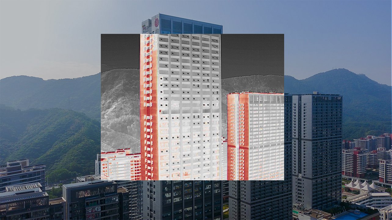
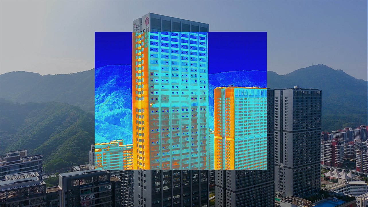
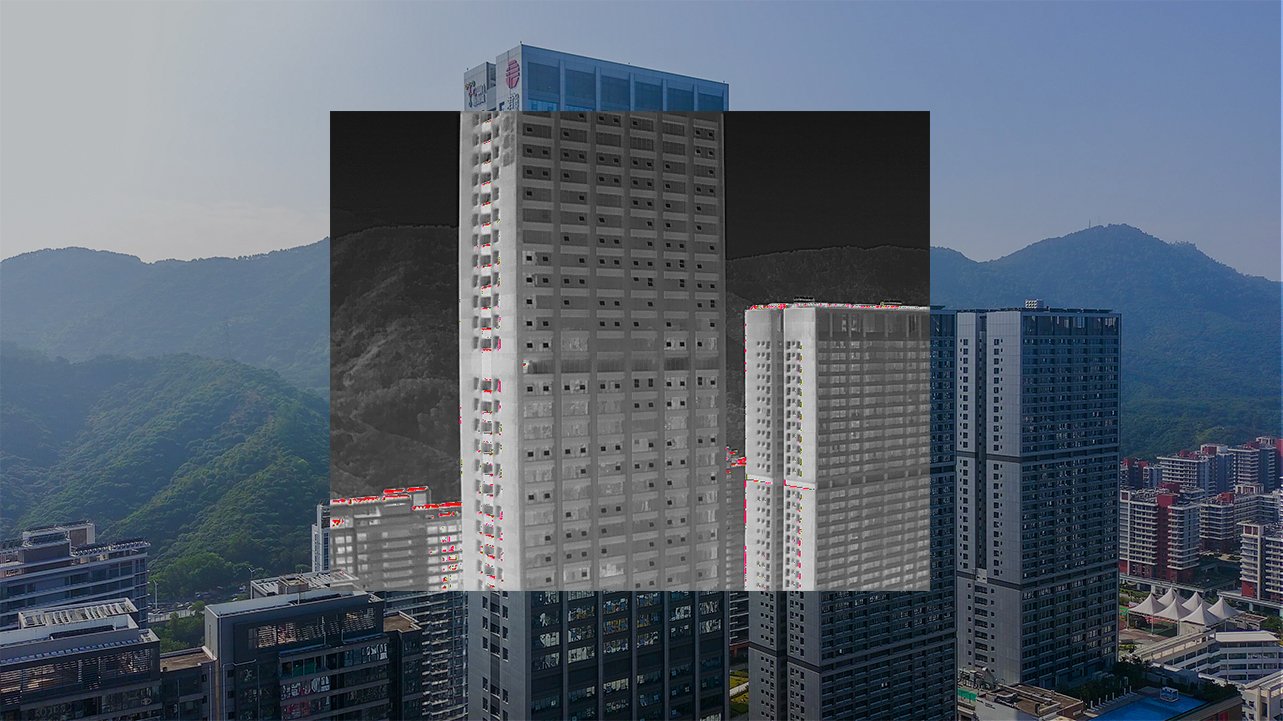
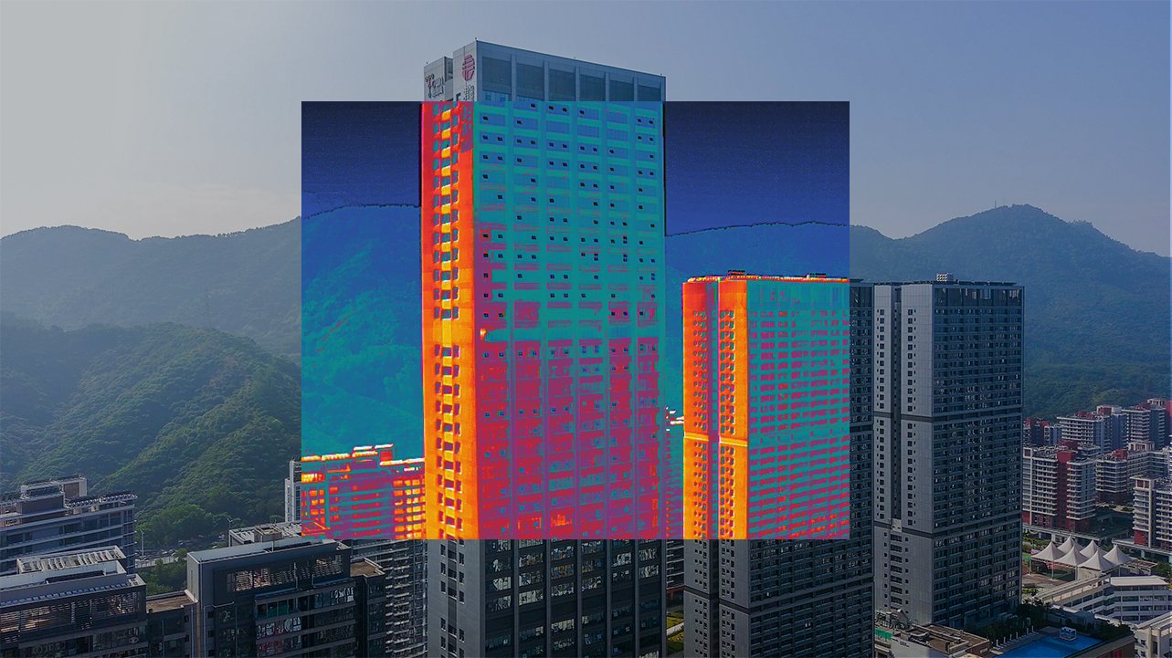
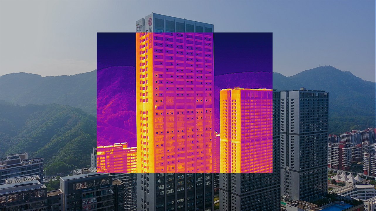
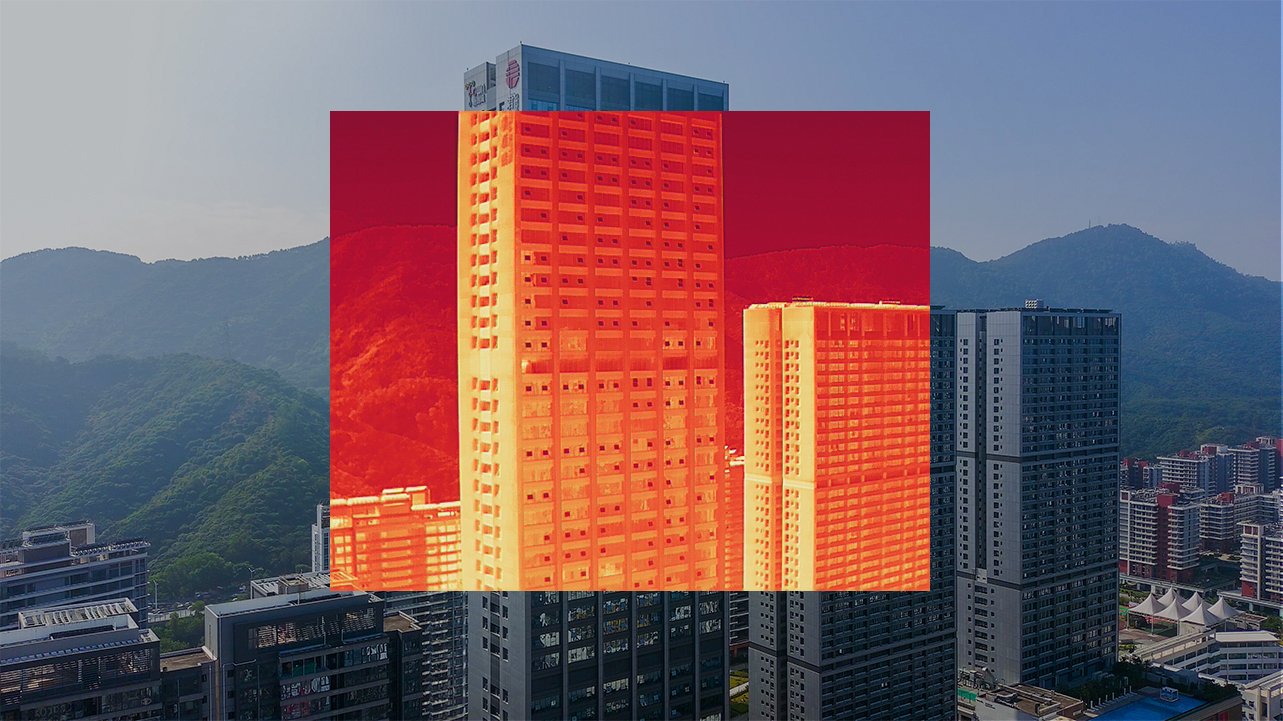
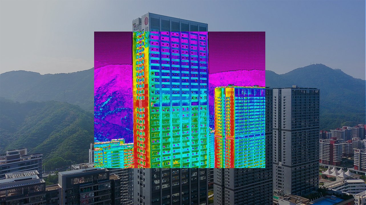
Dual cameras, accurate
temperature measurement
EVO II Dual 640T RTK is equipped with a high resolution thermal
imaging camera and 8K visible light camera, enabling you to
capture highly detailed imagery to achieve optimal insights.
Precise temperature measurement
The EVO II Dual 640T RTK can accurately detect heat sources
within a distance of 2-5 meters. By leveraging the compensation
algorithm of infrared temperature measurement, the 640T RTK can regulate temperature deviations within 3 degrees Celsius.
High-resolution Thermal imaging sensor
The 640T RTK has a 13mm focal length combined with a 640*512
thermal imaging sensor, and an 8K ultra-high-definition visible camera. Together, these sensors provide you with dual vision to give you the crisp and clear imagery you need to accomplish your missions.
Multiple Color Modes
10 color schemes to enable more vivid scene recognition

Capture
every detail
EVO II Pro RTK has high dynamic range and powerful low light performance, enabling users to capture clear imagery without missing any detailed information.
High resolution camera
The 1 inch CMOS sensor coupled with 20 MP and F/2.8-F11 aperture, gives you the versatility and ability to capture the best in a variety of mission scenarios.
6K Ultra HD video
The 6K resolution ultra-high-definition lens, supported by a 1-inch sensor, makes it easy to achieve professional shooting results.
Light, efficient and reliable
The EVO II RTK series inherits the foldable design of the original EVO II series, making it compact, light, portable and ready to fly in just a matter of seconds. Alongside a 9km maximum transmission range, the aircraft offers a flight time of up to 36 minutes and can reach a top speed of up to 20m/s, making it the perfect flying companion for your daily missions.
Max Flight Time
36 min
Max Transmission Range
9 km
Max Speed
20 m/s
Mission execution with
Advanced intelligence
Advanced intelligence
EVO II RTK Series provides users with a full range of intelligent features and solutions to suit a variety of mission needs. Using advanced flight control and the latest AI technology, the aircraft can significantly improve mission work flows and help reduce operating costs.
Mission planning
After creating a flight route, EVO II RTK series can fly on the designated flight path autonomously, enabling a smooth, safe and more efficient flight
Photo
replication
For repeatable data acquisition missions, you can record the drone’s previous shooting positions. All the gimbals, camera, and aircraft movements will be replicated, thus producing a full record of the entire mission.
Omnidirectional sensing & obstacle avoidance
EVO II RTK Series comes built in with a 6-directional sensing system that provides the aircraft with obstacle avoidance capabilities in all directions to enable a safer flight.
No need for ground
control points
EVO II RTK series leverages a high precision RTK module and supports PPK, time synchronization, and is not limited by communication links and network coverage.
RTK / PPK
Coupled with the EVO II Series aircraft is an A-RTK base station and RTK network service.
A-RTK high-precision
gnss base station
The EVO II RTK Series supports A-RTK high-precision GNSS base station to obtain real-time differential data, which makes it possible to obtain the accurate coordinates of the designated target point.
Leave a request for pre-order:
Application field
Powerline Inspection
Law enforcement
Firefighting
Photogrammetry